

Weather Headlines
- NEXT 9 HOURS: Severe thunderstorms likely
- SHORT TERM: Big relief
- LONG TERM: Heat returns
Latest Forecast
CEDAR RAPIDS, Iowa (KCRG) – The more intense round of storms is taking shape.
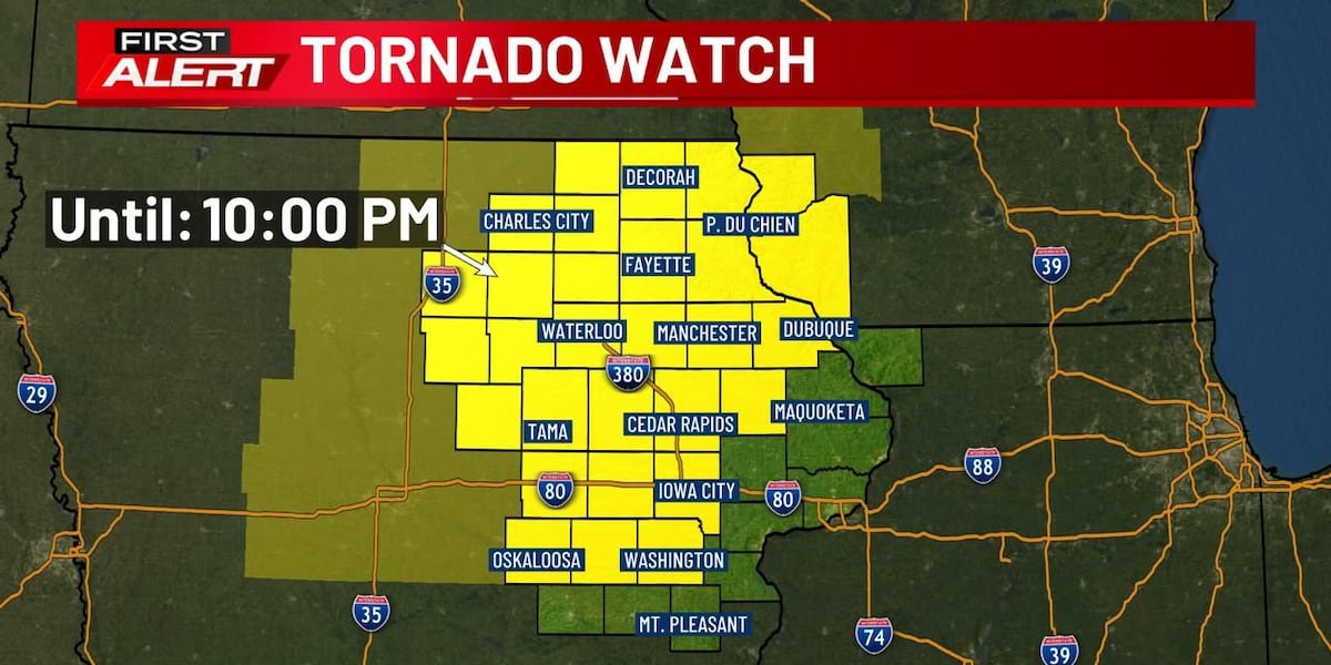
A Tornado Watch has been issued for much of the TV9 viewing area until 10:00 p.m.

(KCRG)
It’s a First Alert Day for the potential of strong to severe storms. Storms are likely, and severe storms are quite possible, too. They will produce damaging wind, large hail, and a tornado or two.
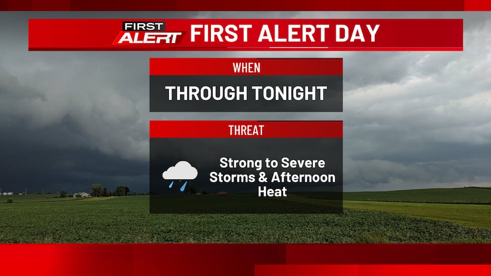
The Storm Prediction Center keeps an Enhanced Risk of severe storms for much of the TV9 viewing area (in orange below). The rest of it is included in a Slight Risk (outlined in yellow). Their thinking aligns with ours in terms of the storm potential today.

(KCRG)
New storm development has occurred, and will intensify between about 3:00 p.m. and 6:00 p.m. Initially, as storms form north of U.S. Highway 20, they will be a bit scattered, with all severe storm hazards possible. There could be some tendency for these storms to congeal into a line, which would lead to an increased damaging wind risk with time. Storms shift southeastward at a fairly quick pace, between about 40 and 50 mph.
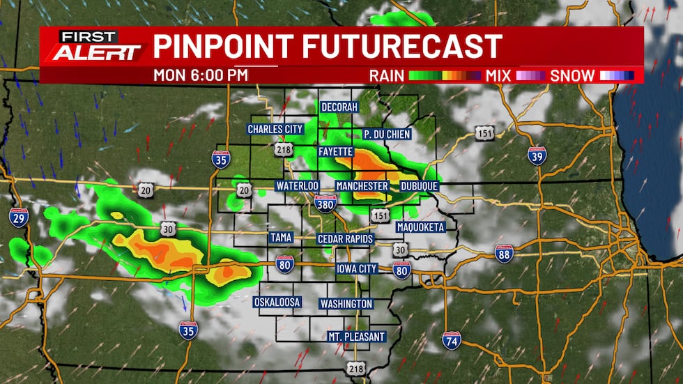
The risk of storms continues into the evening, with the storm threat finally winding down closer to midnight and 3:00 a.m. in the south. After storms come to an end tonight, skies will turn partly cloudy, and winds will shift to a northwesterly direction late.
If a storm approaches your area, seek shelter indoors. If a warning is issued, get to the lowest floor of your home, away from windows. In the event of a tornado warning, put as many walls between you and the outside as possible, like in an interior closet or bathroom. A basement is best if you have one. Cover your head and neck with pillows or blankets, or a bike helmet if you have one. If you’re in a mobile home, abandon it for more substantial shelter. If caught outdoors, try to get to an indoor shelter. As a last resort, lay flat in a ditch while protecting your head and neck. Don’t seek shelter under bridges or overpasses.
It’s important to make sure to have multiple ways to receive warnings. A NOAA Weather Radio is a great tool in this case. Make sure it’s plugged in and turned on, ready to receive warnings, before you head to bed. We also recommend the KCRG-TV9 First Alert Weather App, which can give you customized alerts for your location. Of course, we’ll also provide updates on KCRG.com and KCRG-TV9 as conditions warrant.
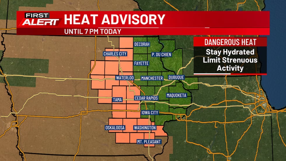
Outside of storms on Monday, there still is a window of opportunity for hot weather to return this afternoon. There’s a Heat Advisory for several counties in the TV9 viewing area to cover this potential, as heat index readings could approach 100 to 105 in some spots as a result. This is the type of heat that, in response, you’ll want to drink plenty of water and take breaks in cooler spaces.
We’re also seeing reduced air quality from wildfire smoke emanating from Canada. This should improve for several hours this afternoon and evening as this smoke shifts away to the east. However, tonight’s cold front will drag another batch southward. This could lead to more air quality in the Orange-Unhealthy for Sensitive Groups to Red-Unhealthy for All. Make sure to check on the latest readings here before spending extended time outdoors, especially if you have a pre-existing heart or lung condition.
Tuesday will be a day of transition, with cooler and drier air already making an impact. It comes with some gusty northwesterly winds, with some of those gusts reaching 30 mph or more. Partly cloudy skies are likely, too. Temperatures will only reach the upper 70s to low 80s. Dew points will drop, too, with readings in the low to mid 60s by the afternoon on Tuesday. For the rest of the work week, those values will actually be as low as the 50s, which is quite nice for late July.
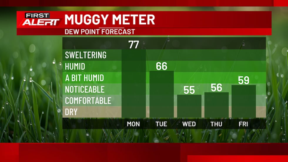
Very comfortable weather is likely for the rest of the work week, with lows in the 50s for most and highs just in the 70s. This is the longest stretch in weeks of temperatures below normal, and should be a great time to get outdoors (pending how our air quality turns out during this time).
An isolated storm is possible on Friday, though the chance looks slim at this point. Afterwards, things heat up again this weekend. 80s return on Saturday, with upper 80s and low 90s likely by Sunday. This comes with higher humidity levels again, as we get another taste of that summertime heat.
A few storms early next week could shift our temperatures downward again. But, low 90s on Monday just give way to mid 80s on Tuesday, so a return to a much cooler air mass doesn’t look likely.
Copyright 2026 KCRG. All rights reserved.