

Severe Storms Prompt Central Florida Power Outages | Watching Saharan Dust & Extreme Weekend Heat
Severe Storms Prompt Central Florida Power Outages | Watching Saharan Dust & Extreme Weekend Heat
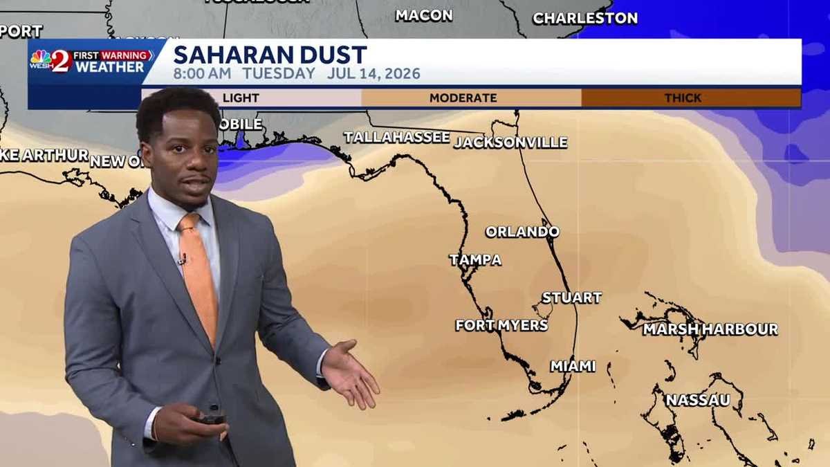
And Marquise, we’ve been dealing with some extreme, uh, weather out there, extreme heat, *** lot of thunderstorms. What are we seeing now? Well, the heat’s not going to die down anytime soon. Now Typically the showers, they offer us some relief from the heat in the afternoon, but those are pushing towards the north and the east across central Florida. And what they’ve left behind are some power outages. Got 100 customers without power in Lake County, and that number multiplies. Supplies as we move across Marion County to 1500 customers without power. So hopefully we can get the lights back on tonight, but it was *** strong and gusty, damaging winds that were the result of those power outages right here across I-75, especially in Ocala. Now for the rest of the night we’re gonna monitor this severe weather risk. It’s marginal, *** 1 out of 5 threat issued by the storm Prediction Center, and we still have some strong. Storms ongoing north of the I-4 quarter. So let’s go ahead and talk about the, uh, damages that we saw in Marion County. Looks like the strong and gusty winds that led to the power outages. These did clip some tree branches, also causing damages to roofs in the area. So that’s just showing the power that we’ve seen throughout these severe instances. Now just light rain left behind in Citra, Anthony, and *** couple of sprinkles. In Ocala out towards the north and the east, uh, pushing closer to I-95 in Bennell, we do see these showers rising from the south across State Road 11 there. Further up across State Road 13 and across I-95 into uh, into, uh, Flagler County across Crescent Beach. We are watching the showers rise from the south. *** couple lighter showers across Mont Verde. We still see the ongoing lightning strikes along Lake, uh, Apopka there. And as we zoom on out in the tourist district, it looks like your rain showers are now coming to an end as well. So what we’re watching throughout the rest of the weekend, the heat advisories, of course, those return tomorrow, and then we have another round of scattered afternoon and evening storms off in Orlando though, 93 degrees, it feels like 90. 5. Once you factor in this southerly breeze coming in at 10 MPH. Mostly sunny skies though are what we’re monitoring for the rest of the evening though, we’ll take *** look at these showers pushing towards the north and the east, likely losing their intensity by 9 and 10 o’clock, and then we dry out. Not going to be cooling down by much though. Overnight temperatures, those will stall in the 70s and 80s here in central Florida. So we’ll lose the impact by 7 o’clock once the intensity begins to fall apart. And then as we take *** look at what to expect tomorrow, well, sunshine is back here in central Florida. Not going to stay sunny forever though. Temperature wise though, we’ll be back in the 70s and 80s tonight. And as we take *** look at future cast, high pressure is trying to squeeze back into the picture tomorrow. Of course, we’re going to see the heat advisories in place as your feels like conditions will be anywhere between 101 and 108 degrees. So your pool forecast, it starts off good, not going to finish off that way as we’ll watch out for those passing showers. Coverage is going to be about 50% tomorrow. Time to get out, as I mentioned, we start off the day with sunshine. Watching that westerly breeze, *** couple of showers in the morning across I-75. These start to balloon in the afternoon and across the early evening. With that south and westerly wind influence, if you’re east of the I-4 quarter, that’s where the better chance for some heavier showers and storms is going to lie as we wrap up your weekend on Sunday. Then to kick off the work week, that plume of air and dust looks like it’s coming back with *** vengeance, drying conditions out just *** bit Tuesday and Wednesday. But with drier weather, we will see an opportunity for warmer conditions for tomorrow though, as we move towards the north, that’s where *** better chance for. Shower coverage is going to lie, but the bigger picture in your forecast will call for those heat indices to creep between 105 and 110 degrees as your work week does continue with this system of high pressure rising across the Atlantic. Seven-day forecast says temperatures peaking at 97 degrees on Monday. Quite the scorcher coming your way. Rain chances to start off the workweek around 40 to 30%, and then we’ll see highs return to the mid-90s by next weekend.
Severe Storms Prompt Central Florida Power Outages | Watching Saharan Dust & Extreme Weekend Heat
Severe Storms Prompt Central Florida Power Outages | Watching Saharan Dust & Extreme Weekend Heat

Severe Storms Prompt Central Florida Power Outages | Monitoring Saharan Dust and Extreme Heat This Weekend
Severe Storms Prompt Central Florida Power Outages | Monitoring Saharan Dust and Extreme Heat This Weekend