

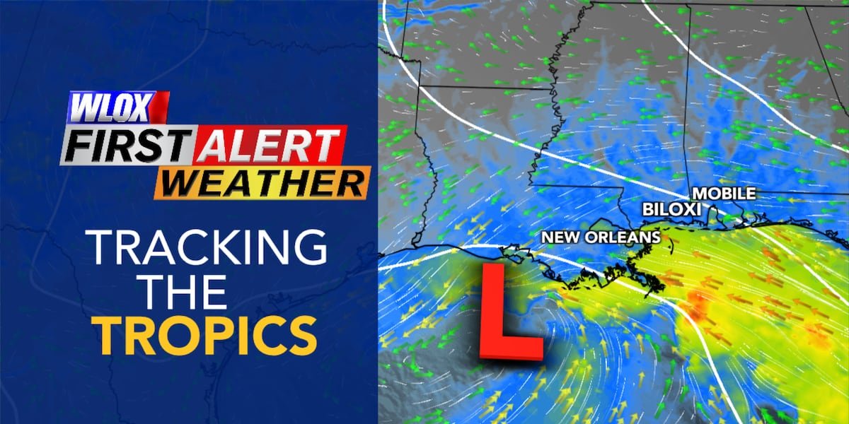
BILOXI, Miss. (WLOX) — An unsettled weather pattern over the Gulf will gradually lead to a weak area of low pressure to develop and lift north towards the central Gulf Coast.
The main impacts are expected to be from strong offshore winds that may lead to minor coastal flooding in low-lying areas across Hancock, Harrison and Jackson Counties through Friday. In addition, scattered storms by the end of the week could lead to localized flash flooding.
Fortunately, tropical development is expected to be limited due to high wind shear.

Coastal Flood Advisory
As this unsettled weather lifts north, strong winds are expected to develop off the Mississippi and Southeast Louisiana coasts.
These persistent onshore winds may lead to higher than normal, causing minor coastal flooding in coastal Hancock, Harrison and Jackson Counties – especially during the high tide cycles.
| LOCATION | HIGH TIDE 6/3 | HIGH TIDE 6/4 | HIGH TIDE 6/5 |
|---|---|---|---|
| BAY ST LOUIS | 1:48 PM | 2:24 PM | 2:55 PM |
| BILOXI | 12:28 PM | 1:05 PM | 1:39 PM |
| PASC. | 11:50 AM | 12:43 PM | 1:34 PM |

A coastal flood advisory means flooding of lots, parks, and roads with isolated road closures is expected. If travel is required, allow extra time as some roads may be closed. Do not drive around barricades or through water of unknown depth. Take the necessary actions to protect flood-prone property – such as parking vehicles on higher ground.

Rain Chances
A front is expected to bring drier air into South Mississippi Wednesday into Thursday, limiting rain chances. However, as the weak low pressure lifts north, tropical moisture will bring the chance for scattered showers and thunderstorms Friday into the weekend across South Mississippi.


See a spelling or grammar error in this story? Report it to our team HERE.
Copyright 2026 WLOX. All rights reserved.