
Hurricane Season Ramps Up Now — What To Know
Atlantic hurricane season has woken up as we enter what is historically the most active time of year. From the western and central Atlantic to Africa, there are multiple areas to watch for tropical development right now.
Here’s what we know.
Tracking Now: Western, Central Atlantic Systems
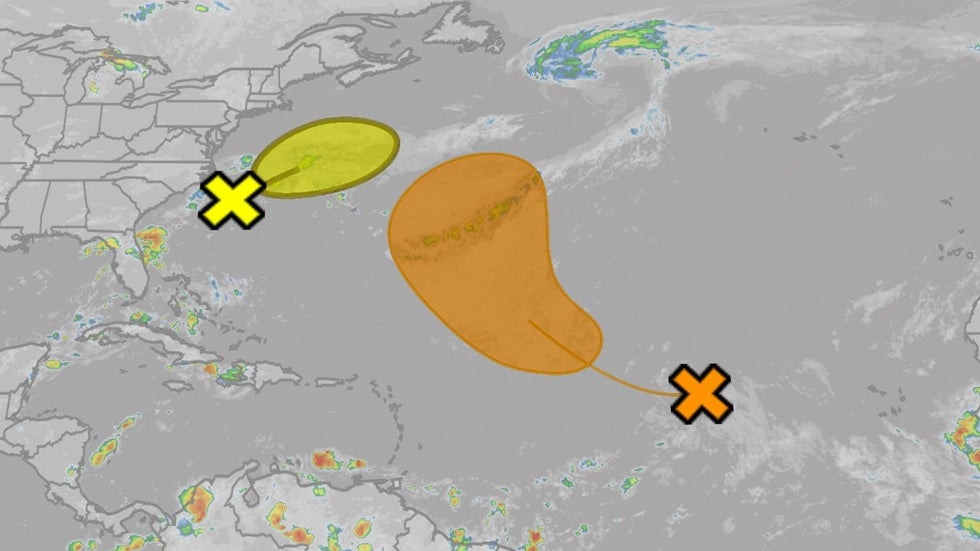
– System Off U.S. East Coast: Weak low pressure is expected to move northeastward away from the East Coast over the next several days. If it sprouts enough thunderstorms, it could become a tropical or subtropical depression or storm this weekend or early next week. It’s no threat to land, but could produce high surf and rip currents along much of the East Coast through this weekend, especially from southeast New England to North Carolina.
Weather in your inbox
– Central Atlantic System: Farther east, an area of lower pressure called a tropical wave is in the central Atlantic Ocean, where it’s producing disorganized showers and thunderstorms. It could develop into a depression or storm by early next week as it curls northwestward. This system is not a threat to the mainland U.S., but depending on how sharp its curl is, it could pass near Bermuda sometime next week.
(MORE: What Is A Tropical Wave?)

Tropical Development Potential
Looking Ahead: All Eyes On New System Emerging From Africa
– The parade of disturbances known as tropical waves will continue off the African coast, as it always does in hurricane season.
– One of those tropical waves is due to move off the African coast around Saturday.
– With an environment of warm water, low wind shear, and gradually increasing moisture, this next tropical wave could develop as soon as early-mid next week between Africa and the Lesser Antilles.
– This next tropical system could eventually pose a threat somewhere in the eastern Caribbean as soon as next Friday or the weekend of August 16-17, and possibly some part of the mainland U.S. sometime during the following week.
– But it’s far too soon to know where any Caribbean or mainland U.S. location may eventually be impacted, if any at all. Now is the time to make sure your hurricane plan is ready to go, before a storm threatens.
– The next tropical storms in the Atlantic Basin will be named Erin, then Fernand.
(MORE: Hurricane Season’s Main Event: Why August Typically Kicks Off The Atlantic’s Most Active Time)
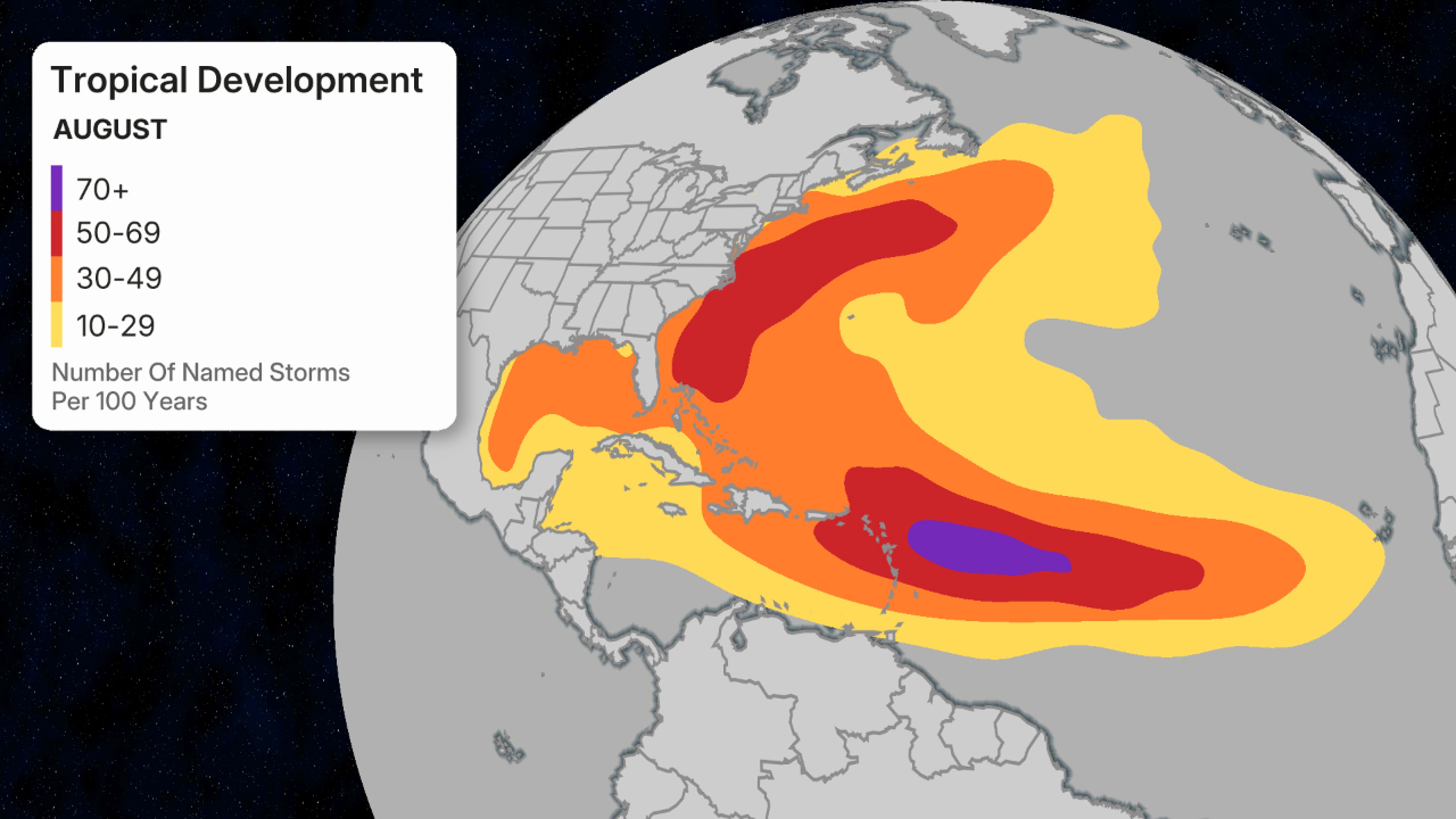
August’s favored named storm formation areas.
(Data: National Hurricane Center)
Jonathan Erdman is a senior meteorologist at weather.com and has been covering national and international weather since 1996. Extreme and bizarre weather are his favorite topics. Reach out to him on Bluesky, X (formerly Twitter) and Facebook.