

MINNEAPOLIS (FOX 9) – Severe storms are pushing across Minnesota early Saturday morning. Here are live updates.
Stay Sky Aware with the FOX 9 Weather App. Whether you are staying in one place or traveling, have your GPS locator on and your notifications turned on. If you drive into a warning, you will get an alert specific to where you are. Apple Download | Android Download
Live updates on overnight storms can be found below. You can check active weather alerts here.
4:07 a.m. – Severe thunderstorm watch extended
The National Weather Service has extended the severe thunderstorm watch that was set to expire at 4 a.m. Saturday through 6 a.m. Saturday and expanded the watch area further east into Wisconsin.
The storms have the potential for damaging winds, hail and heavy rain, which could lead to localized flooding.
3:50 a.m. – Storms pushing into Twin Cities metro
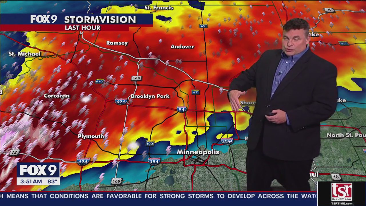
Storms, which have produced heavy rain and lightning, are pushing into the Twin Cities metro. There are no active severe thunderstorm warnings in effect for the Twin Cities metro, but a severe thunderstorm watch is in effect. Heavy rain, gusty winds and maybe some hail are possible, with rainfall amounts of 2-4 inches per hour possible.
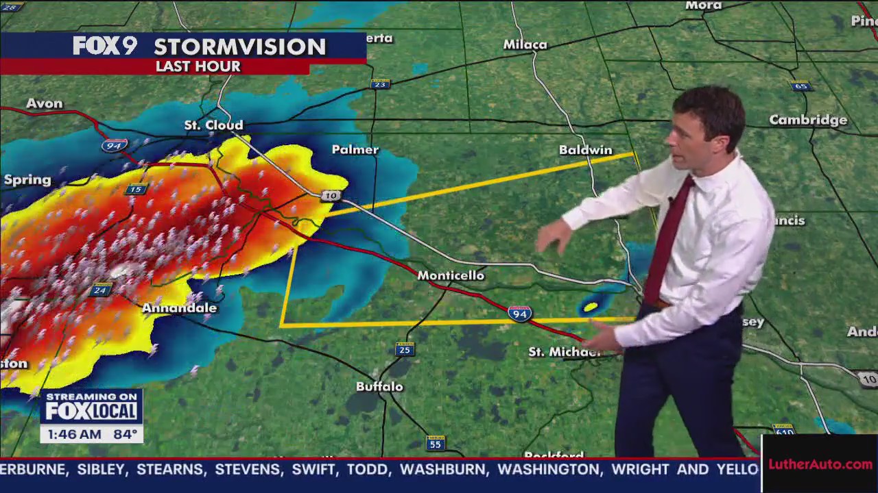
Areas from Buffalo to Maple Lake have picked up about 2+ inches of rain. Some areas in Wright County saw hail.
The severe thunderstorm watch is currently set to expire at 4 a.m. Saturday but there are signs it may be extended.
2:35 a.m. – Storms northwest of the Twin Cities
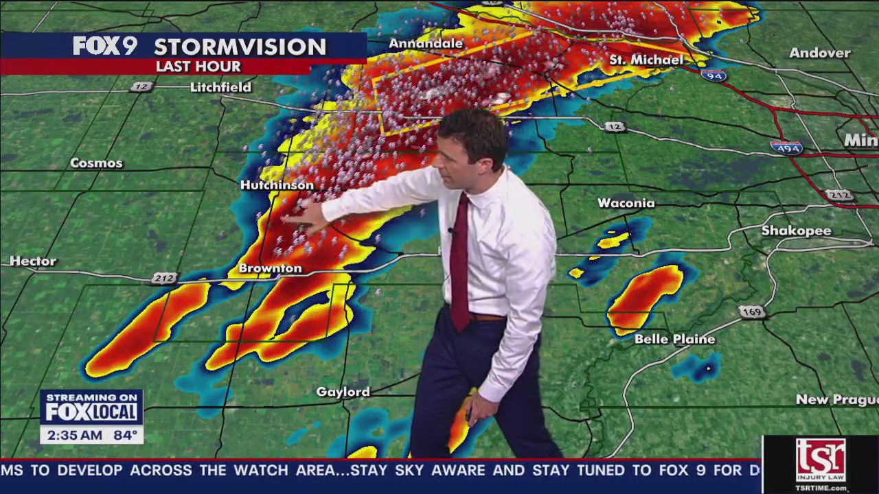
Sherburne and Wright counties are under severe thunderstorm warnings early Saturday morning. The areas are seeing heavy rain, with ponding on roadways possible. No flash flood warnings have been issued as of this writing.
If this trend holds, storms could push into the Twin Cities metro in the next couple of hours.
2:05 a.m. – Heavy rain, lighting
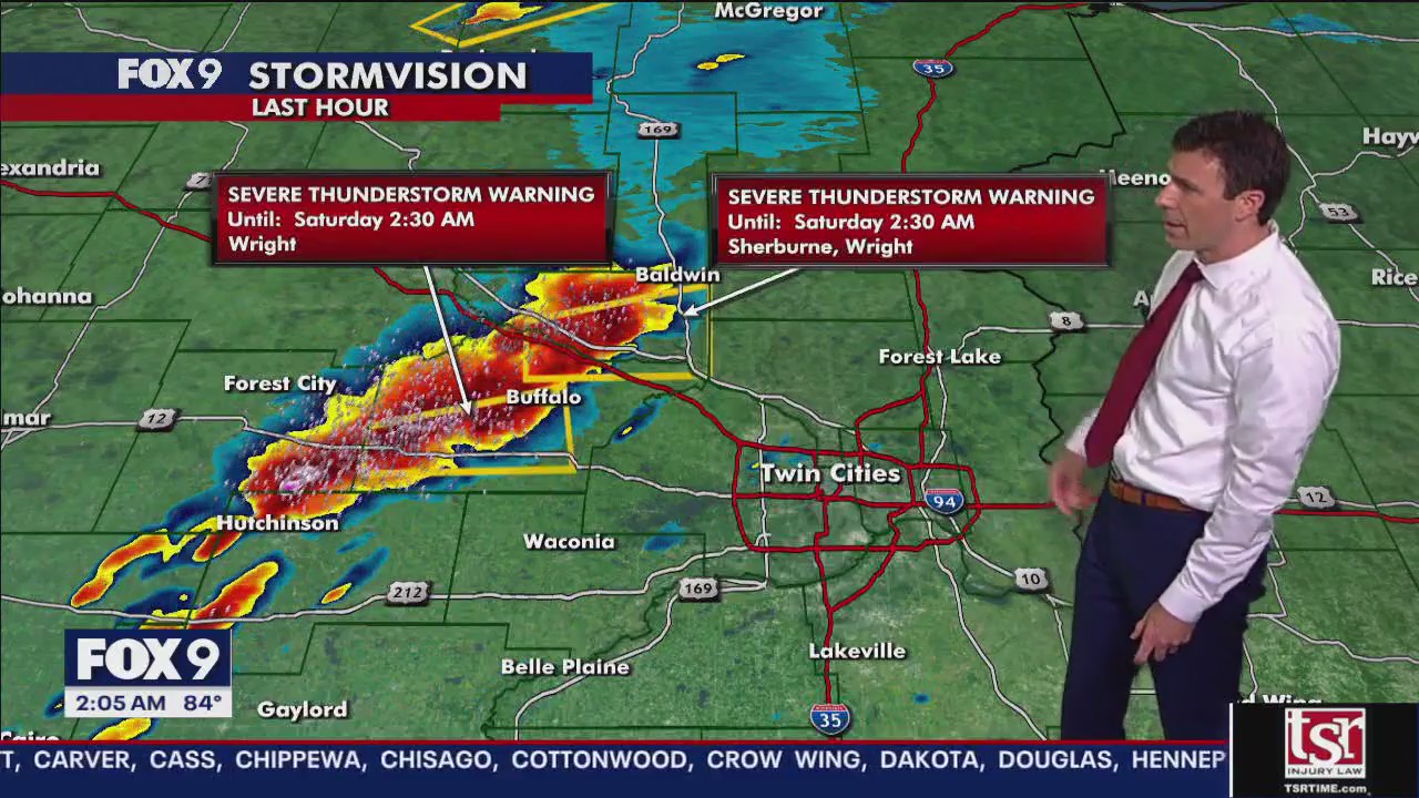
Rainfall rates are about 2 inches over 30 minutes with this storm, which could lead to flash flooding. Lots of lighting is also part of these storms.
You can check active weather alerts here.
1:40 a.m. Saturday – Severe thunderstorm warnings
Severe thunderstorm warnings are starting to pop up in some areas of cabin country, including Pequot Lakes and Crosslake early Saturday, until 2:30 a.m.
A severe thunderstorm warning has also been issued for the Elk River and Monticello area until 2:30 a.m.
You can check active weather alerts here.
9:45 p.m. Friday – Severe thunderstorm watch issued
A severe thunderstorm watch has been issued through 4 a.m. for much of Minnesota, including the Twin Cities metro.
Scattered overnight storms could lead to gusty winds, some hail and even an isolated tornado.
Timeline of what to expect
Storms in Minnesota:
A cold front will plow through the state on Friday night and could trigger a line of powerful storms, initially causing a hail threat for North Dakota and northwestern Minnesota, but transitioning more to a wind threat as the night continues.
There is a level 2 risk of severe storms for all of Minnesota, except southeastern Minnesota, which is under a level 1 marginal risk. The primary threat of this system is 60+ wind gusts and 1-2 inch hail and an isolated tornado.
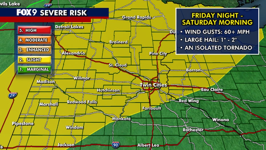
Severe weather risk. (FOX 9)
Timeline:
A line of storms is expected to fire late Friday evening into early Saturday morning in North Dakota and/or northwestern Minnesota and move southeast through the state into early Saturday morning.
The storms may not reach the Twin Cities until after 3 a.m. or possibly as late as 5 a.m. Saturday, and should be exiting the metro on Saturday morning.
You can check active weather alerts here.
Stay Sky Aware with the FOX 9 Weather App. Whether you are staying in one place or traveling, have your GPS locator on and your notifications turned on. If you drive into a warning, you will get an alert specific to where you are. Apple Download | Android Download
Minnesota weekend forecast
What’s next:
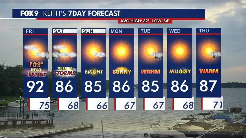
Saturday is expected to be warm and muggy, with highs in the mid-80s and clearing skies after morning storms. Sunday will be mostly sunny and less humid with highs in the mid-80s.
Temperatures are expected to hold steady into the week ahead, staying slightly above average with additional chances for some rumbles.
Here’s a look at the seven-day forecast:
The Source: This story uses information provided by FOX 9 meteorologists.