
KANSAS CITY, Mo. (KCTV) – A hot and humid Friday evening persists with another hot & humid day Saturday. A few waves of rain & storms are possible Saturday.
The First Warn remains in place this evening for the high heat and humidity. Temperatures remain mainly 90 and below but feels-like temperatures sit in the mid 90s to around 100 degrees. We should mainly remain dry across the area this evening.
The 8:30 p.m. kickoff at Kansas City Stadium will still be warm, around 87 degrees, with a heat index of 94. As the sun sets, it will become more bearable.
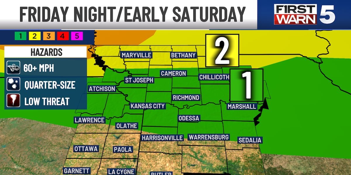
Tonight: Partly cloudy skies are expected tonight with the chance for spotty to scattered rain and storms. The best chance will be after midnight along the northern border due to a complex of storms dropping in from Nebraska. A level 2/5 severe risk is situated for those HWY 36 and north. Wind & hail are the primary threats with an isolated tornado possible.
SATURDAY – FOURTH OF JULY
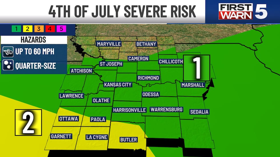
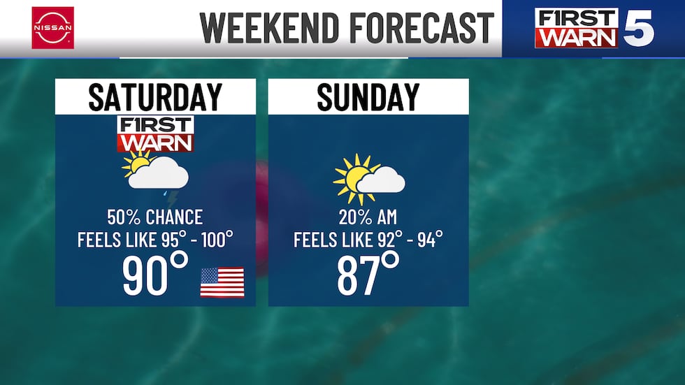
The 4th of July brings another First Warn for both dangerous heat and 2 main waves of rain & storm potential. There is a level 1/5 severe risk highlighted for the metro and a higher 2/5 severe risk along the southern border. There is the possibility at all time for a strong to severe storm but the best chance appears to be in the afternoon to evening round.
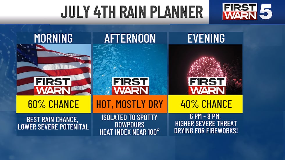
Saturday Morning: There could be a few noisy storms for the KC metro and north as we sleep in the 4-9 a.m. window. Our better chance for KC comes closer to 6 a.m – 8 a.m. with lightning, thunder, and heavy rainfall possible. Keep in mind, we can’t rule out a storm becoming strong to severe. If you have any early morning plans, make sure you have the rain gear handy. Temperatures will be in the low 70s to the low 80s.
IF this morning activity pans out, that could keep us drier later in the day. That also could keep your temperatures a touch more comfortable. IF that morning wave does not pan out, that would set the stage for a higher chance for afternoon and evening storms.
Between rounds of rain, afternoon highs surge in the upper 80s/lower 90s.
Saturday Afternoon to Evening: Another possible batch of scattered rain & storms will be possible for the afternoon to evening. This round placement and possibility is still fairly uncertain. Not everyone will see storms. Current forecast models have the best chance for these storms to form is just along and south of I-70. These have the better chance to be on the stronger to severe side. A few spots could pick up a quick 1″ to 1.5: of rain.
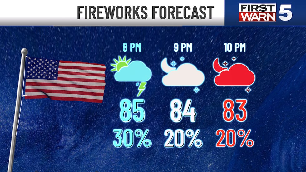
Firework Festivities: The good news is that most of the rain & storm activity on most models show that we will be dry for most of the area by 8 – 10 pm. Just in time for fireworks! However, if you live along our southern border counties, rain and storms may still be ongoing
SUNDAY – BEST WEEKEND DAY!
Not as hot, humid or as stormy! High temperatures sit in the upper 80s and could still feel as hot as 92-94 degrees. Mostly sunny skies.
Most of next week is trending to the upper 80s to near 90-degree mark as well. Not overly hot, but still quite warm. Humidity doesn’t fall off much either.
To get the latest weather updates sent to your phone, download the KCTV5 Weather app here.
Copyright 2026 KCTV. All rights reserved.