
June Outlook: How Will It Feel Where You Live?
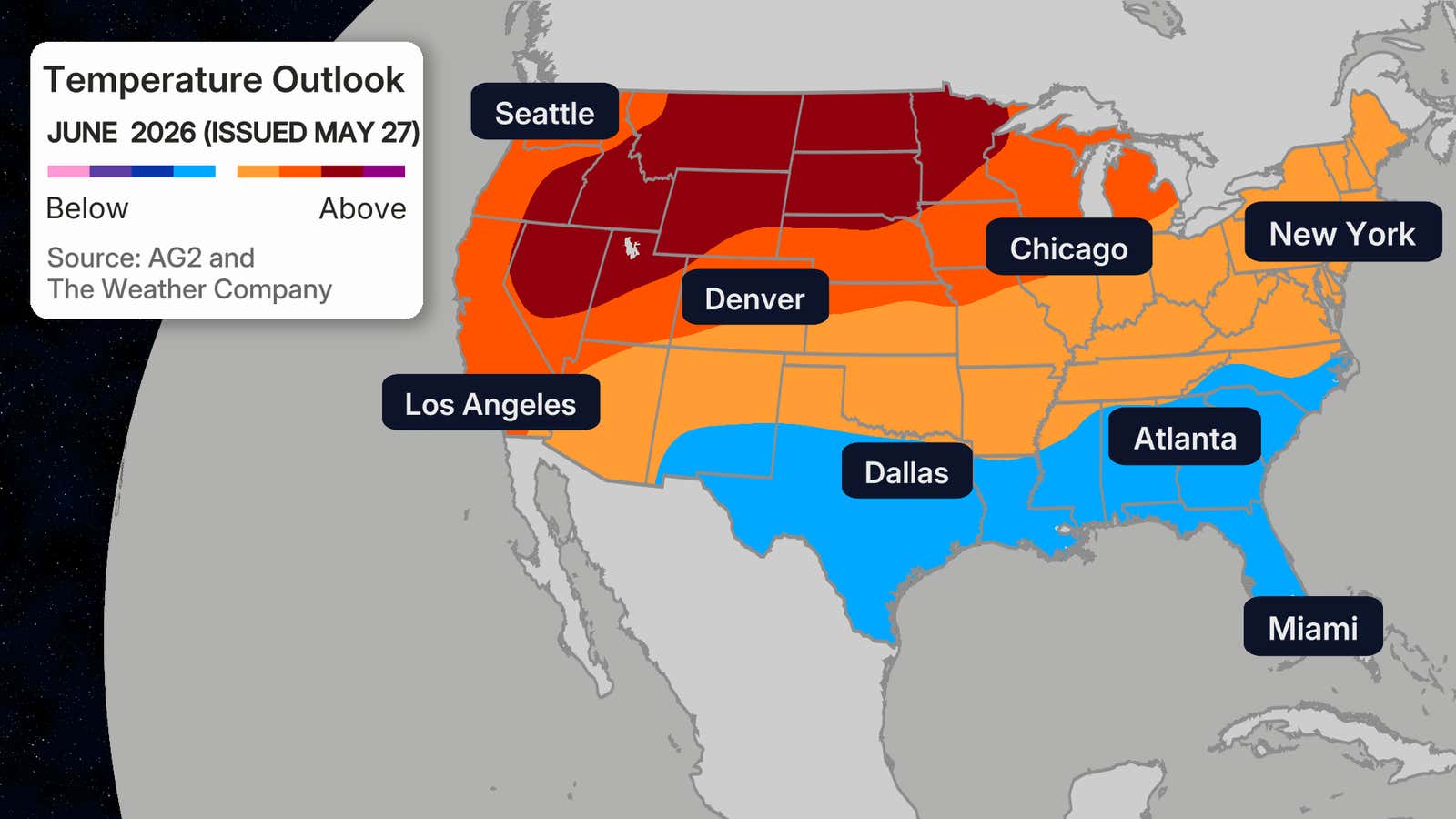
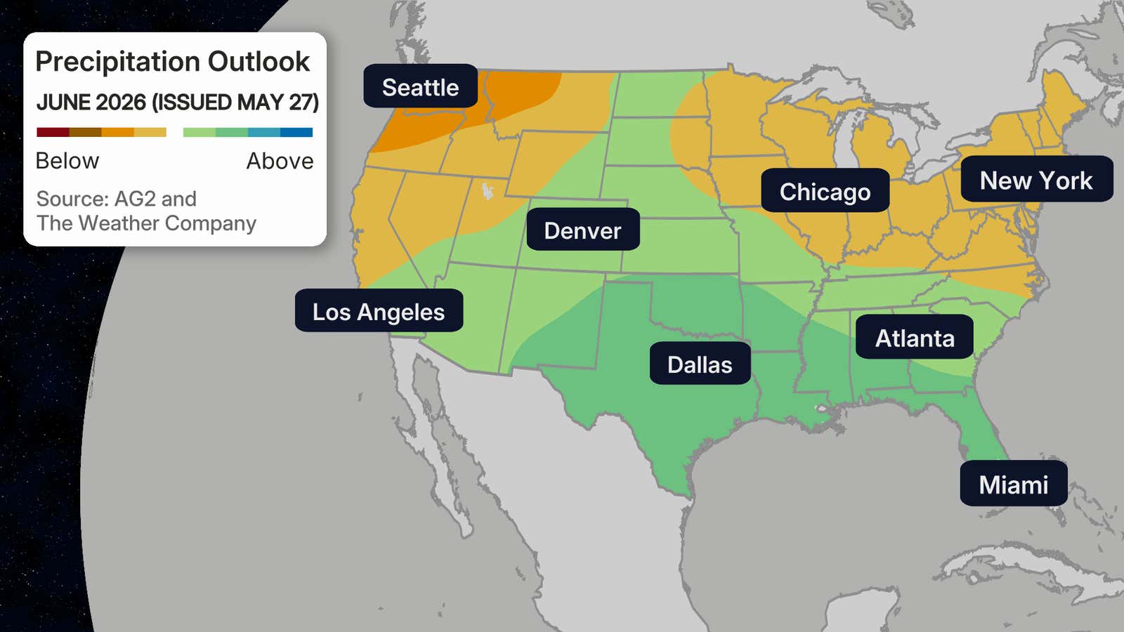
The latest June outlook from The Weather Company and Atmospheric G2 is out, and it features some pretty significant changes.
The new outlook features a much warmer-than-average start to summer from the Upper Midwest to the Intermountain West, meaning that it will feel more like July or August as we near the warmest time of the year.
The Northwest and Northeast are expected to be drier than normal, while rainier weather could keep things cooler across much of the South.
What Changed
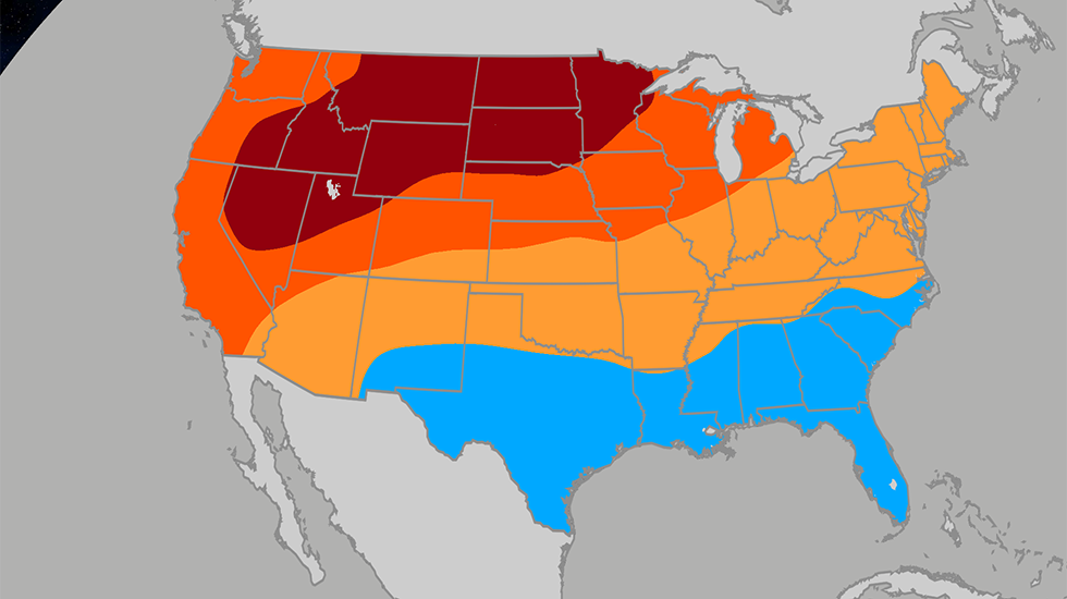
Now, look at the previous temperature outlook, issued May 14. There are some notable changes:
- The South is expected to be much cooler and wetter than in the previous outlook, especially for cities like Miami, New Orleans and Dallas.
- The Northeast is expected to be warmer, but the outlook for precipitation remains consistently drier than average.
- While a wetter than average monsoon remains expected in the Southwest, the firehose may be less potent than previously expected.
- The Great Lakes, which had been forecast to hang onto springtime temperatures, could be warmer to much warmer than average for June.
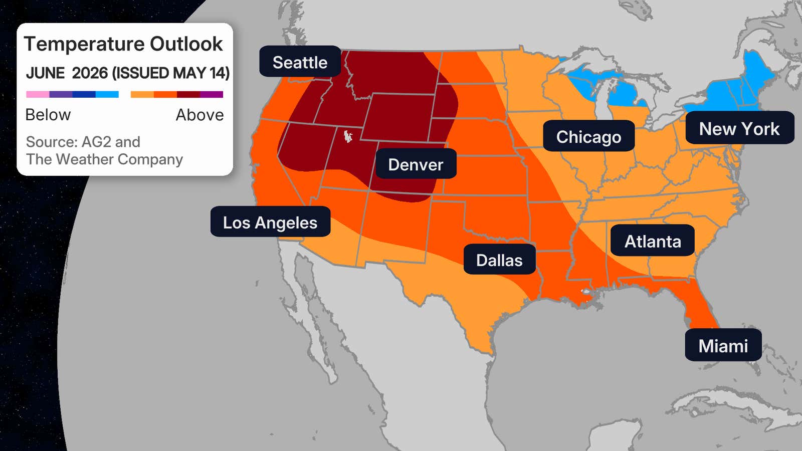
Previous June Temperature Outlook – Issued May 14, 2026
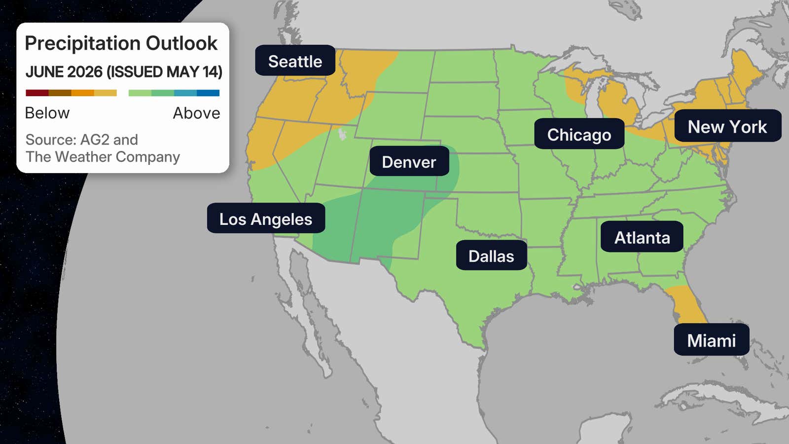
Previous June Precipitation Outlook – Issued May 14, 2026
El Niño’s Influence Already?
The subtropical jet, a belt of strong upper-level winds, is expected to be stronger than usual due to the increasing El Niño conditions. When you have a stronger subtropical jet moving across the Southern portion of the country, you can see a wetter south due to the jet bringing in rounds of moisture.
This jet and the upcoming El Niño could also help enhance the monsoon season across the Desert Southwest, which would help the ongoing drought across Arizona, New Mexico, Utah and Colorado. On the flip side, Junes that occur before a strong El Niño typically bring drier and warmer weather for the Northwest.